 geonetworktest
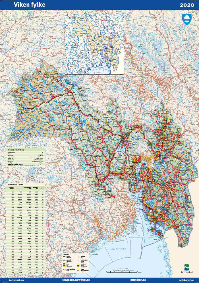
POD - County map
County map
Simple
- Date (Creation)
- 2019-11-14
- Date (Publication)
- 2019-11-14
- Date (Revision)
- 2019-12-12
- Unique resource identifier
- pod_fylkeskart
- Status
- On going
- Maintenance and update frequency
- As needed
- Nasjonal inndeling i geografiske initiativ og SDI-er
-
-
Norway Digital
-
National public data catalog
-
- Place
-
-
Norges fylker
-
- Theme
-
-
Fylkeskart
-
POD - Print on Demand
-
- Specific usage
-
Fylkeskartene er et oversiktskart som viser administrativ inndeling. Egner seg bra som veggkart.
- Access constraints
- Other restrictions
- Other constraints
- Norge digitalt begrenset
- Use constraints
- Other restrictions
- Other constraints
- No conditions apply to access and use
- Classification
- Unclassified
- Spatial representation type
- Grid
- Denominator
- 1:400000
- Metadata language
- Norwegian
- Topic category
-
- Boundaries
N
S
E
W
))
- Begin date
- 0001-01-01
- Unique resource identifier
- EPSG:99999
- Distribution format
-
-
PDF
()
Distributor
- Units of distribution
-
fylkesvis
- OnLine resource
- https://nedlasting.test.geonorge.no/api/capabilities/ ( GEONORGE:DOWNLOAD )
-
PDF
()
Distributor
- OnLine resource
- http://nedlasting2.geonorge.no/geonorge/ATOM-feeds/PODFylkeskart_AtomFeedPDF.xml ( W3C:AtomFeed )
-
PDF
()
- Units of distribution
-
fylkesvis
- OnLine resource
- https://nedlasting.test.geonorge.no/api/capabilities/ ( GEONORGE:DOWNLOAD )
- Hierarchy level
- Dataset
- File identifier
- 10846182-136a-4052-bc37-590686bfed1d XML
- Metadata language
- Norwegian
- Hierarchy level
- Dataset
- Date stamp
- 2025-04-24
- Metadata standard name
-
ISO19115
- Metadata standard version
-
2003
Overviews
original

miniatyrbilde

medium
Spatial extent
N
S
E
W
Provided by

Associated resources
Not available