 geonetworktest
Simplified Elveg Roads OGC API - Features - Test
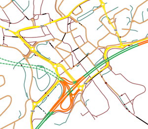
The service is new in spring 2023 and follows the "OGC API - Features" standard. The service is a test service used in the EU project GEOE3. You are welcome to use the service for technology development and testing, but we point out that the service can change and be taken down without warning. \\n\\nSimplified Elveg 2.0 is a simplified version of the road network data set Elveg 2.0 and only contains road link geometry and road barriers. The data set includes all drivable roads that are longer than 50 metres, or are part of a network, as well as pedestrian and cycle paths and cycle paths represented as road link geometry.\\n\\nElveg 2.0 is an export from the National Road Data Bank (NVDB) and is kept up-to-date by the Norwegian Road Administration and the Mapping Authority.
Simple
Identification info
- Date (Creation)
- 2023-11-28
- Date (Publication)
- 2023-11-28
- Date (Revision)
- 2023-11-28
- Status
- Under development
- Maintenance and update frequency
- Weekly
- GEMET - INSPIRE themes, version 1.0
-
-
Transportnett
-
- Nasjonal inndeling i geografiske initiativ og SDI-er
-
-
Inspire
-
Felles datakatalog
-
dataNorgeNo
-
- Nasjonal tematisk inndeling (DOK-kategori)
-
-
Samferdsel
-
- Place
-
-
Norge fastland
-
- Theme
-
-
Roads
-
Road network
-
- Use limitation
-
No conditions apply
- Access constraints
- Other restrictions
- Other constraints
- Åpne data
- Use constraints
- Other restrictions
- Other constraints
- Creative Commons BY-NC 4.0 (CC BY-NC 4.0)
- Service Type
- other
- Ordering instructions
-
https://register.geonorge.no/metadata-kodelister/norge-digitalt-tjenesteerklaering/B
))
- Begin date
- 0001-01-01
- Coupling Type
- Tight
Contains Operations
- Operates On
- Unique resource identifier
- EPSG:25833
- Distribution format
-
-
GeoJSON
(
1.0
)
-
GeoJSON
(
1.0
)
- OnLine resource
- accessPoint ( OGC:OAPIF )
- Hierarchy level
- Service
- Other
-
service
Domain consistency
Conformance result
- Date (Publication)
- 2010-12-08
- Date
- Explanation
-
The data is not evaluated according to the product specification
Conformance result
- Date (Publication)
- 2010-12-08
- Date
- Explanation
-
This Spatial Data Service set is not evaluated conformant with the INSPIRE Implementing Rules for the interoperability of spatial data sets and services
Conformance result
- Date (Publication)
- 2016-05-01
- Date
- Explanation
-
This Spatial Data Service set is not evaluated conformant with the INSPIRE requirements for Interoperable Spatial Data Services
Conceptual consistency
- Name of measure
- availability
- Measure description
-
Lower limit of the percentage of time the service is estimated to be available on a yearly basis
Quantitative result
- Value
- 95
Conceptual consistency
- Name of measure
- capacity
- Measure description
-
Lower limit of the maximum number of simultaneous requests that can be completed within the limits of the declared performance
Quantitative result
- Value
- 40
Conceptual consistency
- Name of measure
- performance
- Measure description
-
The maximum time in which a typical request to the Spatial Data Service can be carried out in a off-peak load situation
Quantitative result
- Value
- 4
- File identifier
- 128c1fea-aaad-4d5b-ab69-8ab6df94e89d XML
- Metadata language
- Norwegian
- Hierarchy level
- Service
- Hierarchy level name
-
service
- Date stamp
- 2024-10-09T16:04:16
- Metadata standard name
-
ISO19115
- Metadata standard version
-
2003
Overviews


Spatial extent
Provided by
