 geonetworktest
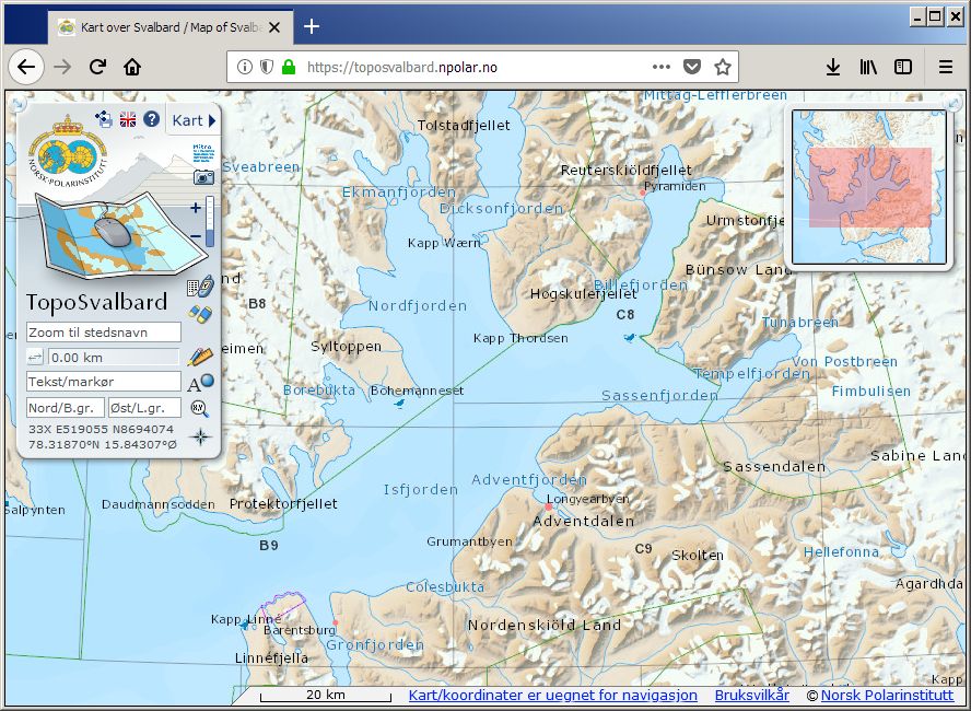
TopoSvalbard
TopoSvalbard is the Norwegian Polar Institute's topographical application for Svalbard, and contains map, orthophoto and satellite image layers (summer and winter), nautical charts (Norwegian Mapping Authority), as well as terrain visualisations in 2D and 3D. Beyond basic functionality as coordinate readings and place name searches, distance measurements and data plotting, the user can also browse place names information, landscape photos, old oblique aerial photos and singular currently unrectified aerial images.
Simple
- Date (Creation)
- 2018-08-13
- Date (Publication)
- 2018-08-13
- Date (Revision)
- 2018-08-13
- Status
- On going
- Maintenance and update frequency
- Irregular
- Place
-
-
Svalbard
-
- Theme
-
-
Basiskart
-
Stedsnavnsøk
-
Terrengmodell
-
Kartbladinndeling
-
Sjøkart
-
Landkart
-
Koordinattransformasjon
-
Flyfoto
-
Landskapsbilder
-
Satellittbilder
-
- Use limitation
-
Ingen begrensninger på bruk er oppgitt.
- Access constraints
- Other restrictions
- Use constraints
- Intellectual property rights
- Other constraints
-
no restrictions
- Classification
- Unclassified
- Denominator
- 100000
- Topic category
-
- Imagery base maps earth cover
N
S
E
W
))
- Distribution format
-
- Units of distribution
-
regional inndeling
- OnLine resource
- https://toposvalbard.npolar.no ( WWW:LINK-1.0-http--link )
- Hierarchy level
- Service
- File identifier
- ed64a121-efbb-4818-8228-d892299176cc XML
- Metadata language
-
nor
- Hierarchy level
- Software
- Date stamp
- 2018-08-13
- Metadata standard name
-
ISO19115
- Metadata standard version
-
2003
Overviews
original

miniatyrbilde

medium
Spatial extent
N
S
E
W
Provided by

Associated resources
Not available