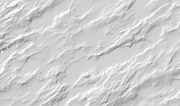
Sea shadow relief WMS
The WMS service shows the depth conditions in Norwegian sea areas as shadow relief with resolutions of 5 m, 25 m, 50 m. The data on the map is scale-dependent and more details are shown when one zooms into the map. If you zoom into the map, this will automatically take you to 50-meter resolution, then on to 25 meters and – if the data is detailed enough – down to a 5-meter resolution between depth points. There are 5 meter and 25 meter grids, but only outside the territory boundary (12 nautical miles) as data within the territorial boundary is classified by the Norwegian Armed Forces. The very few areas, which have been released by the Norwegian Armed Forces, are exempted from this. The shadow relief is derived mainly from regular grids (terrain models), which are based solely on modern multibeam surveys. The dataset has best coverage in the areas in Northern Norway where the Norwegian Mapping Authority Hydrographic Service and partners have carried out hydrographic surveys over the past few years. The dataset also has some coverage in Central Norway and will be extended as new hydrographic surveys are carried out and terrain models are produced for the seabed.
Simple
Identification info
- Date (Creation)
- 2018-06-07
- Date (Publication)
- 2018-06-07
- Date (Revision)
- 2018-06-07
- Purpose
- Seabed visualisation
- Status
- On going
- Maintenance and update frequency
- Continual
- Nasjonal inndeling i geografiske initiativ og SDI-er
-
-
Inspire
-
Geodata Act
-
Norway Digital
-
Mareano
-
- Nasjonal tematisk inndeling (DOK-kategori)
-
-
Basis geodata
-
- Place
-
-
Norway
-
northern Norway
-
mid-Norway
-
- Theme
-
-
WMS
-
seabed
-
ocean
-
-
COMMISSION REGULATION (EC) No 1205/2008 of 3 December 2008 implementing Directive 2007/2/EC of the European Parliament and of the Council as regards metadata, Part D 4, Classification of Spatial Data Services
- Keywords
-
-
MAREANO
-
Norwegian Hydrographic Service
-
Shadow relief
-
DTM
-
depth data
-
Terrain models
-
Terrain shadow data
-
Seafloor
-
Depth data
-
Grid
-
Grid models
-
Raster
-
Seafloor raster data
-
Bathymetry
-
GeoTiff
-
- Specific usage
-
This data is not approved for navigation. Seabed visualisation may provide a basis for planning at a overview scale . Other examples of applications are: academic use – research; mapping of habitats; geological mapping; marine construction planning; offshore activities; and visualisation at various scales. More details on usage can be found on the website about the product: https://www.kartverket.no/en/data/kartdataer/Marine-Geospatial-Data/Terrain-Models-of-the-Seabed/
- Use limitation
-
Ingen begrensninger på bruk er oppgitt, unntatt at data kan ikke brukes til navigasjon.
- Access constraints
- Other restrictions
- Other constraints
- Åpne data
- Use constraints
- Other restrictions
- Other constraints
- Creative Commons BY 4.0 (CC BY 4.0)
- Other constraints
-
5 m grid og 25 m grid finnes kun utenfor territorialgrensen (12 nautiske mil), siden disse data er gradert av Forsvaret innenfor territorialgrensen. Det finnes et par unntak.
- Classification
- Unclassified
- Service Type
- view
- Ordering instructions
))
- Begin date
- 0001-01-01
- Coupling Type
- Tight
Contains Operations
- Distribution format
-
-
wms
()
-
wms
()
- OnLine resource
- https://wms.geonorge.no/skwms1/wms.havbunnraster3?service=WMS&request=GetCapabilities ( OGC:WMS )
- Hierarchy level
- Service
- Other
-
service
Domain consistency
Conformance result
- Date (Publication)
- 2010-12-08
- Date
- Explanation
-
The data is not evaluated according to the product specification
Conformance result
- Date (Publication)
- 2010-12-08
- Date
- Explanation
-
This data set is not evaluated conformant with the INSPIRE Implementing Rules for Network Services
- Statement
-
Ingen prosseshistorie tilgjenglig. Datasettet har best dekning i de områder i Nord-Norge der Statens kartverk sjødivisjonen og samarbeidsparter har sjømålt de siste årene. Datasettet har også noe dekning i Midt_Norge og vil utvides i takt med ny sjømåling og produksjon av terrengmodeller for havbunn.
- File identifier
- 010c3fc4-3551-47aa-b10a-e01735bd1c0f XML
- Metadata language
- Norwegian
- Hierarchy level
- Service
- Hierarchy level name
-
service
- Date stamp
- 2025-02-03T11:01:19
- Metadata standard name
-
ISO19115
- Metadata standard version
-
2003
Overviews


Spatial extent
))
Provided by

 geonetworktest