 geonetworktest
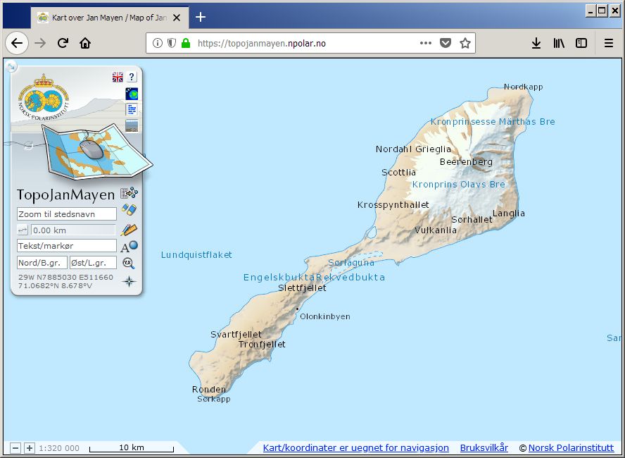
TopoJanMayen
TopoJanMayen is the Norwegian Polar Institute's topographical application for Jan Mayen, and contains maps and satellite images. Beyond basic functionality as coordinate readings and place name searches, distance measurements and data plotting, the user can also browse place names information and landscape photos.
Simple
- Date (Creation)
- 2018-08-13
- Date (Publication)
- 2018-08-13
- Date (Revision)
- 2018-08-13
- Status
- On going
- Maintenance and update frequency
- Irregular
- Place
-
-
Jan Mayen
-
- Theme
-
-
Basiskart
-
Stedsnavnsøk
-
Terrengmodell
-
Landkart
-
Koordinattransformasjon
-
Landskapsbilder
-
Satellittbilder
-
- Use limitation
-
Ingen begrensninger på bruk er oppgitt.
- Access constraints
- Other restrictions
- Use constraints
- Intellectual property rights
- Other constraints
-
no restrictions
- Classification
- Unclassified
- Denominator
- 100000
N
S
E
W
))
- Distribution format
-
- Units of distribution
-
regional inndeling
- OnLine resource
- https://topojanmayen.npolar.no/ ( WWW:LINK-1.0-http--link )
- Hierarchy level
- Service
- File identifier
- 0b7e1ed3-d9c8-44a9-8038-2b4ea2c9aeec XML
- Metadata language
-
nor
- Hierarchy level
- Software
- Date stamp
- 2018-08-13
- Metadata standard name
-
ISO19115
- Metadata standard version
-
2003
Overviews
original

miniatyrbilde

medium
Spatial extent
N
S
E
W
Provided by

Associated resources
Not available