 geonetworktest
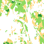
SAT-FOREST - Total tree volume
National forest resource map classifying forest by tree type, age and volume at an aggregate level.
The forest resource map is automatically derived from satellite imagery using ground data from the National Forest Inventory and clipped to forest areas in national land resource maps.
The forest resource map is made in scale 1:50.000 with a geometric accuracy of 15 meters.
Simple
- Date (Publication)
- 2010-01-06
- Date (Creation)
- 0001-01-01
- Date (Revision)
- 0001-01-01
- Unique resource identifier
- SAT-SKOG Volum
- Purpose
-
Provide resource data for strategic forestry planning, wildfire management, compensation for logging ban in protected areas and planning of timber transportation.
- Status
- Completed
64948001
- Maintenance and update frequency
- Not planned
- Nasjonal inndeling i geografiske initiativ og SDI-er
-
-
Open data
-
Norway Digital
-
National public data catalog
-
Modellbaserte vegprosjekter
-
- Nasjonal tematisk inndeling (DOK-kategori)
-
-
Agriculture
-
- Place
-
-
Norge
-
- Theme
-
-
Skog
-
Volum
-
Fjernmåling
-
Satellitt
-
- Use limitation
-
Ingen begrensninger på bruk er oppgitt.
- Access constraints
- Other restrictions
- Other constraints
- Åpne data
- Use constraints
- Other restrictions
- Other constraints
- Norsk lisens for offentlige data (NLOD)
- Spatial representation type
- Vector
- Denominator
- 50000
- Metadata language
- Norwegian
- Topic category
-
- Farming
))
- Begin date
- 0001-01-01
- Supplemental Information
- The forest resource map is derived from automatic interpretation of satellite imagery from Landsat 5 and 7. Ground verification data stems from the National Forest Inventory which has sample plots in a 3x3 km grid covering the whole of Norway. Terrain data from the national digital terrain model 10x10 is also used. Forest areas include all areas classified as forest in national land resource database at scale 1:5000.
- Unique resource identifier
- EPSG:4258
- Unique resource identifier
- EPSG:25832
- Unique resource identifier
- EPSG:25833
- Unique resource identifier
- EPSG:25835
Spatial representation info
- Distribution format
-
-
ESRI Shape
()
Distributor
- Units of distribution
-
Municipality
- OnLine resource
- https://kart8.nibio.no/api/capabilities/ ( GEONORGE:DOWNLOAD )
-
GML
(
4.0
)
Distributor
- Units of distribution
-
Municipality
- OnLine resource
- https://kart8.nibio.no/api/capabilities/ ( GEONORGE:DOWNLOAD )
-
ESRI Shape
()
Distributor
64948001
- Name
-
Shape
- Name
-
sosi
- Units of distribution
-
Municipality
- OnLine resource
- https://kart8.nibio.no/api/capabilities/ ( GEONORGE:DOWNLOAD )
- Hierarchy level
- Dataset
- Statement
-
The dataset has not been changed since it was established in 2010.
- File identifier
- 55e51b75-c325-4201-b164-10ebdb30bef0 XML
- Metadata language
- Norwegian
- Parent identifier
-
SAT-FOREST
ee232937-578e-4e4b-b35c-c50c0473fc25
- Hierarchy level
- Dataset
- Date stamp
- 2021-09-29
- Metadata standard name
-
ISO19115
- Metadata standard version
-
2003
Overviews

Spatial extent
Provided by
