 geonetworktest
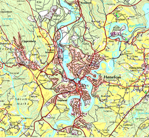
N50 Raster (UTM32) - Map tiles
N50 Raster uses similar presentation (symbols) to the map series Norway 1:50,000. N50 Raster is delimited by the national borders with neighbouring countries and the territorial boundaries in the sea. The dataset includes hydrographic information.
N50 Raster is based on N50 Map Data and distributed weekly.
N50 Raster in GeoTIFF format is supplied in 20 km x 20 km tiles.
The following reference files accompany the GeoTIFF format: SOSI and TFW.
Simple
- Date (Creation)
- 2001-01-01
- Date (Publication)
- 0001-01-01
- Date (Revision)
- 2022-12-06
- Unique resource identifier
- N50 Raster
- Status
- On going
- Maintenance and update frequency
- Weekly
- Nasjonal inndeling i geografiske initiativ og SDI-er
-
-
Beredskapsbase
-
Norway Digital
-
National public data catalog
-
- Place
-
-
Norge fastland
-
- Theme
-
-
Map data
-
N50
-
Raster
-
N50 Raster
-
Landsdekkende
-
1:50 000
-
Norway 1:50 000
-
M711
-
Hicking map
-
Map over Norway
-
1:50000
-
Norge 1:50000
-
N 50
-
Nasjonalt datasett
-
Bakgrunnskart
-
GeoTIFF
-
- Specific usage
-
N50 Raster is suitable for printing for hiking purposes, as background information for planning and display of statistics and analyses, interactive maps and as data for map solutions on the Internet.
- Use limitation
-
Ingen begrensninger på bruk er oppgitt
- Access constraints
- Other restrictions
- Other constraints
- Åpne data
- Use constraints
- Other restrictions
- Other constraints
- Creative Commons BY 4.0 (CC BY 4.0)
- Classification
- Unclassified
- Spatial representation type
- Grid
- Denominator
- 50000
- Metadata language
- Norwegian
- Topic category
-
- Imagery base maps earth cover
))
- Begin date
- 0001-01-01
- Supplemental Information
-
If you need some help to download and start to use data and/or services from the Norwegian Mapping Authority, please use Kartverket.no for tips and guidance.
- Unique resource identifier
- EPSG:25832
- Distribution format
-
-
TIFF
()
Distributor
- Units of distribution
-
cellevis, kommunevis
- OnLine resource
- https://nedlasting.test.geonorge.no/api/capabilities/ ( GEONORGE:DOWNLOAD )
-
TIFF
()
Distributor
- OnLine resource
- http://nedlasting2.geonorge.no/geonorge/ATOM-feeds/N50RasterUTM32_AtomFeedTIFF.xml ( W3C:AtomFeed )
-
TIFF
()
- Units of distribution
-
cellevis, kommunevis
- OnLine resource
- https://nedlasting.test.geonorge.no/api/capabilities/ ( GEONORGE:DOWNLOAD )
- Hierarchy level
- Dataset
Conformance result
- Date (Publication)
- Date
- Explanation
-
The data is according to the product specification
- File identifier
- bbe517ba-3b3a-4c96-a78e-104f6c4804d1 XML
- Metadata language
- Norwegian
- Hierarchy level
- Dataset
- Date stamp
- 2025-04-27
- Metadata standard name
-
ISO19115
- Metadata standard version
-
2003
Overviews


Spatial extent
Provided by
