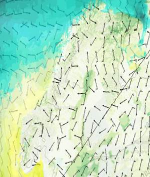
Meteorologisk kartinformasjon
Karttjeneste med prognosedata fra værmodeller og havmodeller, samt observasjoner fra radar og satelitt.
Simple
Identification info
- Date (Creation)
- 2021-07-01
- Date (Publication)
- 2021-07-01
- Date (Revision)
- 2021-07-01
- Purpose
-
Spre kunnskap om kommende vær og bidra til å sikre liv og verdier som er sårbare for værforhold.
- Maintenance and update frequency
- Continual
- Nasjonal inndeling i geografiske initiativ og SDI-er
-
-
Inspire
-
geodataloven
-
- Theme
-
-
Vær
-
Hav
-
-
COMMISSION REGULATION (EC) No 1205/2008 of 3 December 2008 implementing Directive 2007/2/EC of the European Parliament and of the Council as regards metadata, Part D 4, Classification of Spatial Data Services
- Specific usage
-
Planlegging av aktiviteter som er avhengig av været.
- Access constraints
- Other restrictions
- Other constraints
- Åpne data
- Use constraints
- Other restrictions
- Other constraints
- Creative Commons BY-NC 4.0 (CC BY-NC 4.0)
- Service Type
- view
))
- Begin date
- 0001-01-01
- Coupling Type
- Tight
Contains Operations
- Unique resource identifier
- EPSG:32633
- Distribution format
-
-
WMS
(
1.3.0
)
-
WMS
(
1.3.0
)
- Units of distribution
-
landsfiler
- OnLine resource
- https://metmaps.met.no/metmaps/default.map?&SERVICE=WMS&VERSION=1.3.0&REQUEST=GetCapabilities ( OGC:WMS )
- Hierarchy level
- Service
- Other
-
service
Domain consistency
Conformance result
- Date (Publication)
- 2010-12-08
- Date
- Explanation
-
The data is not evaluated according to the product specification
Conformance result
- Date (Publication)
- 2010-12-08
- Date
- Explanation
-
This data set is not evaluated conformant with the INSPIRE Implementing Rules for Network Services
- File identifier
- c247f4a3-56a8-49fa-afe0-a0329b9453e1 XML
- Metadata language
- Norwegian
- Hierarchy level
- Service
- Hierarchy level name
-
service
- Date stamp
- 2021-09-20
- Metadata standard name
-
ISO19115
- Metadata standard version
-
2003
Overviews


Spatial extent
))
Provided by

 geonetworktest