 geonetworktest
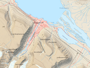
NPI Base map Svalbard WMTS 25833
The service contains the official topographical data for Svalbard
Simple
Identification info
- Date (Creation)
- 0001-01-01
- Date (Publication)
- 0001-01-01
- Date (Revision)
- 2021-03-08
- Status
- On going
- Maintenance and update frequency
- Irregular
- GEMET - INSPIRE themes, version 1.0
-
-
Coordinate reference systems
-
Geographical names
-
Transport networks
-
Hydrography
-
Elevation
-
Land cover
-
Buildings
-
Utility and governmental services
-
Production and industrial facilities
-
- Theme
-
-
Svalbard, basiskart, topografisk
-
-
COMMISSION REGULATION (EC) No 1205/2008 of 3 December 2008 implementing Directive 2007/2/EC of the European Parliament and of the Council as regards metadata, Part D 4, Classification of Spatial Data Services
- Use limitation
-
No conditions apply
- Access constraints
- Other restrictions
- Other constraints
- Åpne data
- Use constraints
- Other restrictions
- Other constraints
- Creative Commons BY 4.0 (CC BY 4.0)
- Classification
- Unclassified
- Service Type
- view
N
S
E
W
))
- Begin date
- 0001-01-01
- Coupling Type
- Tight
Contains Operations
No information provided.
- Distribution format
-
-
OGC WMTS
(
1.0
)
-
OGC WMTS
(
1.0
)
- Hierarchy level
- Service
- Other
-
service
- Statement
- No lineage available
- File identifier
- c4a65937-8308-4282-acde-d2cc4b529ddc XML
- Metadata language
- Norwegian
- Hierarchy level
- Service
- Hierarchy level name
-
service
- Date stamp
- 2021-03-08
- Metadata standard name
-
ISO19115
- Metadata standard version
-
2003
Overviews

original

miniatyrbilde
medium
Spatial extent
N
S
E
W
Provided by

Associated resources
Not available