 geonetworktest
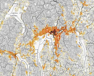
Building stock statistics on grid 5000m 2019
Building stock statistics on grid 5000m x 5000m
Simple
- Date (Creation)
- 2019-09-11
- Date (Publication)
- 2019-09-11
- Date (Revision)
- 2020-01-21
- Unique resource identifier
- bygning_rutenett_5000_2019
- Purpose
-
Kartet egner seg for overordnet planlegging.
- Status
- Completed
- Maintenance and update frequency
- Annually
- GEMET - INSPIRE themes, version 1.0
-
-
Bygninger
-
- Nasjonal inndeling i geografiske initiativ og SDI-er
-
-
Norway Digital
-
Felles datakatalog
-
- Nasjonal tematisk inndeling (DOK-kategori)
-
-
Demography
-
- Theme
-
-
bygningsmasse
-
grid statistics
-
Statistics
-
- Specific usage
-
Dataene egner seg for fremstilling av temakart, oversiktskart, interaktive kart, kartløsninger på internett og til geografiske analyser På webkart anbefales det at Bygningsstatistikk på rutenett benyttes i målestokksområdet fra 1:25 000 til 1:5 000 000. 250m x 250m : fra 1: 25 000 til 1: 250 000 1km x 1km : fra 1: 100 000 til 1:1 000 000. 5km x 5 km : fra 1: 500 000 til 1:5 000 000.
- Use limitation
-
Ingen begrensninger på bruk er oppgitt.
- Access constraints
- Other restrictions
- Other constraints
- Åpne data
- Use constraints
- Other restrictions
- Other constraints
- Norsk lisens for offentlige data (NLOD)
- Other constraints
-
Ingen
- Classification
- Unclassified
- Spatial representation type
- Vector
- Denominator
- 500000
- Metadata language
- Norwegian
- Topic category
-
- Society
))
- Begin date
- 0001-01-01
- Unique resource identifier
- EPSG:25832
- Unique resource identifier
- EPSG:25833
- Unique resource identifier
- EPSG:25835
- Unique resource identifier
- EPSG:3035
- Unique resource identifier
- EPSG:4258
- Distribution format
-
-
PostGIS
(
9.4
)
Distributor
- Units of distribution
-
fylkesvis, kommunevis, landsfiler
- OnLine resource
- https://nedlasting.test.geonorge.no/api/capabilities/ ( GEONORGE:DOWNLOAD )
-
SOSI
(
4.5
)
Distributor
- Units of distribution
-
fylkesvis, kommunevis, landsfiler
- OnLine resource
- https://nedlasting.test.geonorge.no/api/capabilities/ ( GEONORGE:DOWNLOAD )
-
FGDB
()
Distributor
- OnLine resource
- http://nedlasting2.geonorge.no/geonorge/ATOM-feeds/BygningsmassestatistikkRutenett5km2019_AtomFeedFGDB.xml ( W3C:AtomFeed )
-
GML
()
Distributor
- OnLine resource
- http://nedlasting2.geonorge.no/geonorge/ATOM-feeds/BygningsmassestatistikkRutenett5km2019_AtomFeedGML.xml ( W3C:AtomFeed )
-
PostGIS
()
Distributor
- OnLine resource
- http://nedlasting2.geonorge.no/geonorge/ATOM-feeds/BygningsmassestatistikkRutenett5km2019_AtomFeedPostGIS.xml ( W3C:AtomFeed )
-
SOSI
()
Distributor
- OnLine resource
- http://nedlasting2.geonorge.no/geonorge/ATOM-feeds/BygningsmassestatistikkRutenett5km2019_AtomFeedSOSI.xml ( W3C:AtomFeed )
-
PostGIS
(
9.4
)
- Units of distribution
-
fylkesvis, kommunevis, landsfiler
- OnLine resource
- https://nedlasting.test.geonorge.no/api/capabilities/ ( GEONORGE:DOWNLOAD )
- Hierarchy level
- Dataset
- Statement
-
Bygningsstatistikken er basert på Matrikkelen. For mer informasjon: http://www.ssb.no/bygg-bolig-ogeiendom/ statistikker/bygningsmasse
Statistikk på rutenett oppdateres årlig for alle tema og publiseres samtidig med de ordinære statistikker. Pga ulike etterslep i registre vil statistikkene komme utover i
året. Datasett for hver årgang tas vare på slik at man kan følge utvikling over tid.
- File identifier
- e7c936be-f1af-4a42-ba8e-be842303013a XML
- Metadata language
- Norwegian
- Parent identifier
-
Bygningsmassestatistikk på rutenett 5000 m
cc74a4b2-8649-453e-9abf-453f25b21fc6
- Hierarchy level
- Dataset
- Date stamp
- 2025-04-23
- Metadata standard name
-
ISO19115
- Metadata standard version
-
2003
Overviews


Spatial extent
Provided by
