 geonetworktest
biannually
Type of resources
Available actions
Topics
Keywords
Contact for the resource
Provided by
Years
Formats
Representation types
Update frequencies
status
Service types
Scale
-

-

The municipal plan must be the general steering document for the municipality. It must provide a framework for businesses' plans and measures, and plans for use and conservation of spaces in the municipality. All municipalities must have a municipal plan. A collective municipal plan is made up of both a community element with an action element and a spatial element. By adopting a municipal plan strategy, the municipality decides whether the municipality is to implement a full municipal plan revision of all elements, or whether just elements of the municipal plan are to be revised, and what this revision is to be based on. The municipal plan must safeguard municipal, regional and national objectives, interests and tasks, and it should include all important objectives and tasks in the municipality. It must be based on the municipal plan strategy and be based on guidelines and orders from governmental and regional authorities. Municipal subplans can be prepared for specific areas, themes or business areas. The municipal plan must have an action element which indicates how the plan is to be followed up over the next four years or more, and be revised annually (Regjeringen.no). The dataset is generated from the nationwide copy of municipal plans. This is kept updated with data from the original plan data at the municipalities. Updating takes place by means of periodic copying from the municipalities' data or synchronisation.
-

These themes show fishing activity based on data from satellite tracking and catch reporting. Tracking data is linked with information from catch reporting in order to filter out periods involving activities other than fishing, before generating a line density plot. Norwegian fishing vessels are shown per quarter. All fishing vessels of more than 15 metres transmit position reports to the Norwegian Fisheries Monitoring Centre (FMC). The boundary is 12 metres outside 4 nautical miles in the Skagerrak. The normal tracking frequency is one position report per hour. The coverage level declines north of a latitude of N76˚ depending on the type of tracking equipment. Norwegian vessels report independent area, while foreign vessels only transmit data when they are in our waters: The Norwegian Economic Zone, the fishing zone around Jan Mayen and the fish conservation zone at Svalbard. We have no data from Russian, British or Irish vessels in the fish conservation zone. Foreign fishing vessels are shown per year. Foreign vessels only transmit data when they are in our waters: The Norwegian Economic Zone, the fishing zone around Jan Mayen and the fish conservation zone at Svalbard. We have no data from Russian, British or Irish vessels in the fish conservation zone (outside the territorial boundary). Like Norwegian vessels, EU vessels also report their electronic catch logs every day, while Russian vessels only report catches per week.
-

WMS service which includes topographical maps on a scale of 1:500 to 1:10 million. The service is divided into layers.
-

WMS service showing municipal plans. The plan data on which the service is based is made up of copies of the original data administered by the municipalities.
-

-

Karttjenesten viser teoretisk beregnet dekningsområde for nødnett ved bruk av håndholdt radioterminal
-
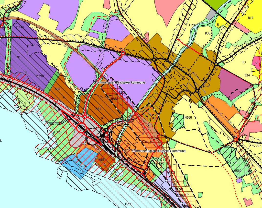
Kommuneplanen skal være kommunens overordnede styringsdokument. Den skal gi rammer for virksomhetenes planer og tiltak, og planer for bruk og vern av arealer i kommunen. Alle kommuner skal ha en kommuneplan. En samlet kommuneplan består både av en samfunnsdel med handlingsdel og en arealdel. Kommunen bestemmer gjennom vedtak av kommunal planstrategi om kommunen skal gjennomføre en full kommuneplanrevisjon av alle delene, eller om bare deler av kommuneplanen skal revideres, og hva revisjonen skal gå ut på. Kommuneplanen skal ivareta både kommunale, regionale og nasjonale mål, interesser og oppgaver, og bør omfatte alle viktige mål og oppgaver i kommunen. Den skal ta utgangspunkt i den kommunale planstrategien og legge retningslinjer og pålegg fra statlige og regionale myndigheter til grunn. Det kan utarbeides kommunedelplan for bestemte områder, temaer eller virksomhetsområder. Kommuneplanforslag er i denne sammenheng plankartet som utarbeides i forbindelse med revisjonen av kommuneplanen. Datasettet genereres fra den landsdekkende kopien av kommuneplanforslag . Dette holdes oppdatert med data fra de originale plandataene i kommunene. Oppdateringen skjer ved periodisk kopiering fra kommunene sine data eller synkronisering.
-

Karttjenesten viser teoretisk beregnet dekningsområde for nødnett ved bruk av håndholdt radioterminal