OGC WMTS
Type of resources
Provided by
Years
Formats
Update frequencies
status
Service types
-

Tjenesten inneholder en Sentinel 2-mosaikk produsert på scener fra Copernicus
-

The service contains the official topographical data for Jan Mayen. Derived from the 25829 service.
-

The service contains the orthophotos currently produced for Svalbard
-

Circumpolar basic map with transparency, combining topographic details from the Norwegian Mapping Authority and the Norwegian Polar Institute south to latitude X (southern France). It also includes map data from the other Arctic countries that is published via the Arctic Spatial Data Infrastructure (Arctic SDI). This map does not include place names and road names – these can be added using the circumpolar place name cache service.
-

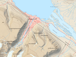
The service contains the official topographical data for Svalbard
-

The service contains the official topographical data for Svalbard
-

The service contains a Sentinel 2 mosaic based on scenes from Copernicus
-

The service contains the orthophotos currently produced for Svalbard. Derived from the 25833 service.
-

The service contains a Landsat8 mosaic based on scenes from USGS
-

The service contains the official topographical data for Svalbard
 geonetworktest