 geonetworktest
software
Type of resources
Available actions
Topics
Keywords
Contact for the resource
Provided by
Years
Formats
Update frequencies
status
Scale
-

-

-

The map application 'National area information' is developed by NGU (Geological Survey of Norway) to show the diversity of tematic area information that is available as map services on the web. The application include all the WMS services from NGU that is accessible through Norway digital (the national geographical infrastructure). It also include selected WMS services from public agencies/departments which offers thematic data that is interesting to show in relation to geological information.
-

The Marine Spatial Management Tool (Arealverktøyet) contains maps that show natural resources, environmental status, business activities, plans and regulations and various reference data. Excerpts from these can be compiled, shared with others and printed. In the analysis module one can follow the development of selected parameters over time or as seasonal variation in maps through a time slider, or as graphs. The assignment to develop a tool for updating the management plans for the maritime zone and dissemination of these, was issued in 2013 to the Forum for Integrated Marine Management and BarentsWatch in the Meld. St. 37 (2012–2013) Report to the Storting (white paper) - "Integrated Management of the Marine Environment of the North Sea and Skagerrak (Management Plan)". The project group that was set up has since developed the solution to what it is today. The first version of the The Marine Spatial Management Tool was launched on November 15, 2016 and it is still under development. The tool is basically designed to support the work of comprehensive management plans for the marine areas and make the knowledge available to the public. The solution shows the professional basis for overall management plans through authoritative data provided by the different sectors. The Refererence guide (in Norwegian) gives a brief introduction to how the system can be used. Contributions and requests for access to the system or wish to attend demonstrations of new functionality can be sent to arealverktoy@barentswatch.no
-
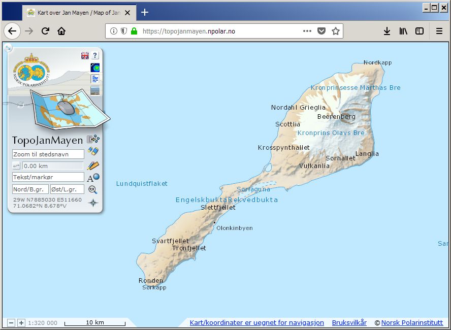
TopoJanMayen is the Norwegian Polar Institute's topographical application for Jan Mayen, and contains maps and satellite images. Beyond basic functionality as coordinate readings and place name searches, distance measurements and data plotting, the user can also browse place names information and landscape photos.
-

-

-

-

-

Kystinfo is a web map solution of the Norwegian Coastal Administration. Kystinfo displays a collection layers with data and information on marine and maritime interests. In addition, the solution present national data on natural and cultural values as well as datasets as properties, oil installations, etc. from other norwegian state agencies.